

Managing geological data is no longer just about storing information. Modern exploration teams need to quickly compare changes, collaborate securely, analyse large datasets, and keep workflows moving without unnecessary friction.
1point v1.8.1 introduces a range of improvements designed around how geologists actually work. Depth correction, faster maps, improved drillhole management, secure sharing, enhanced tagging, and streamlined data workflows all work together to create a more connected and efficient experience.
The result is a platform that gives teams greater visibility, stronger control, and more confidence in their geological data.
Precision depth corrections in 1point
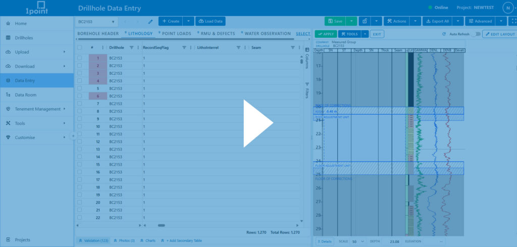
Refine drillhole intervals with greater control using 1point’s new depth correction mode. Adjust lithology intervals directly within the graphic log using tools to insert, duplicate, split, resize, and move intervals, while automatically tracking impacts across related tables. Preview all proposed changes, review validation issues, and apply corrections with confidence, knowing every adjustment can be reviewed, undone, or restored through change history.
Smarter secure folder sharing in 1point
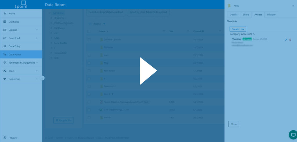
We’ve made it easier to securely manage and share folders within your organisation using enhanced Folder Access Control in 1point.
Admins can now create company access links that are restricted to users within your organisation. Admins stay in full control with editable permissions, revocation at any time, and secure acceptance-based access. If an invitation email is missed or lost, it can be resent instantly. Access is only activated once the recipient accepts the invitation, ensuring secure, intentional entry every time.
To learn more about additional data room sharing options, including public and private links, watch the full overview here.
Instantly compare drillhole versions in 1point
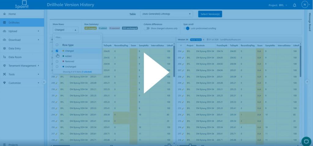
You can now instantly compare drillhole versions in 1point across any table, including, lithology, assay, header, and more. From the version history page, compare additions, removals, and changes side by side. You can focus analysis and highlight only the relevant updated rows, isolate changed columns and use synced scrolling to quickly spot differences.
Query-based drillhole tagging
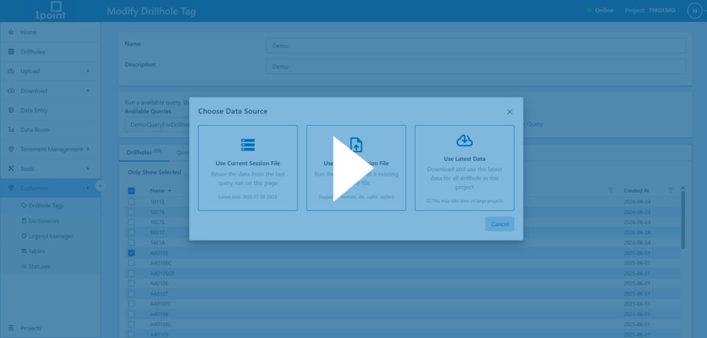
1point’s drillhole tagging is now powered by the query builder, making consistent drillhole groupings even easier. Tags can be created, edited, and refreshed at any time to keep selections up to date across the project. From the tools tab, users can build or modify tags using saved queries or create new ones with the query builder. Learn more about the query builder in this video.
Improved map speed, filtering, and data layers
The map has been significantly optimised for speed and performance. Drillholes now load faster, with only holes within the current view rendered to improve responsiveness. Table filters now also restrict the map view to appropriate drillholes, delivering a much smoother experience. Users can also choose to load only selected drillholes to further improve map speed when working with large datasets.
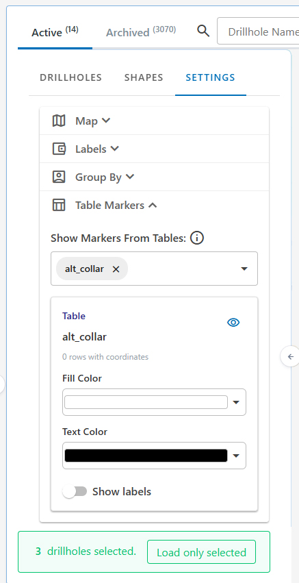
In addition to performance improvements, the map now supports visualising point data from multiple tables, not just the header table. New table markers allow users to select additional tables, apply labels, and customise styling, giving greater flexibility in how spatial data is displayed.
Switch projects instantly
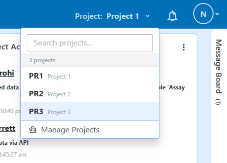
You can now quickly switch between projects from anywhere in 1point using the project dropdown in the top navigation bar, allowing you to change projects in one click and continue working without interruption.
Faster data entry with improved offline monitoring
Data entry has been optimised for a faster, smoother experience, with improved responsiveness across workflows including graphic logs and general data entry. By reducing unnecessary requests to the renderer, interactions are now quicker and more seamless, from initial loading through to everyday editing.
New offline monitoring also provides real-time connection status directly in the top navigation, displaying green when online and red when offline. A last saved timestamp makes it easy to confirm when data was last synced, giving users greater confidence when working in the field or with intermittent connectivity.

User access management controls
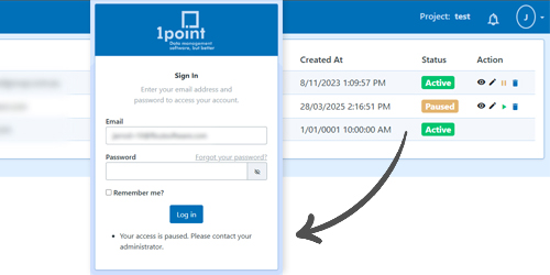
A new additional layer of security for managing user access across your organisation, teams, and projects means admins can pause user access to a company. This immediately revokes user login while preserving existing permissions for when access is restored. If users have access to other companies, they can continue working without interruption, while restricted users receive a clear notification to contact their administrator.
Column merging for improved data consistency
New column merging feature allows users to combine two existing columns by selecting primary and secondary fields and assigning a new name. This automatically generates a new version across all relevant drillholes, ensuring consistency without overwriting existing data.
Legend manager enhancements
The legend manager has been enhanced to provide greater flexibility and control when managing visualisation settings. Users can now update legend cells directly, link legends to specific table columns from within the legend manager, and streamline setup without needing to navigate through table settings.
Additional improvements include the ability to apply rainbow colouring to selected legend rows rather than the entire legend, providing more control over how geological data is represented and visualised.
Edit files directly inside the data room
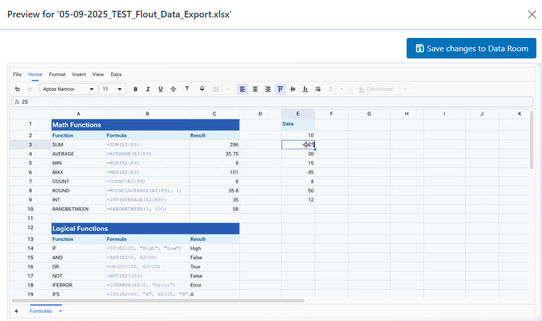
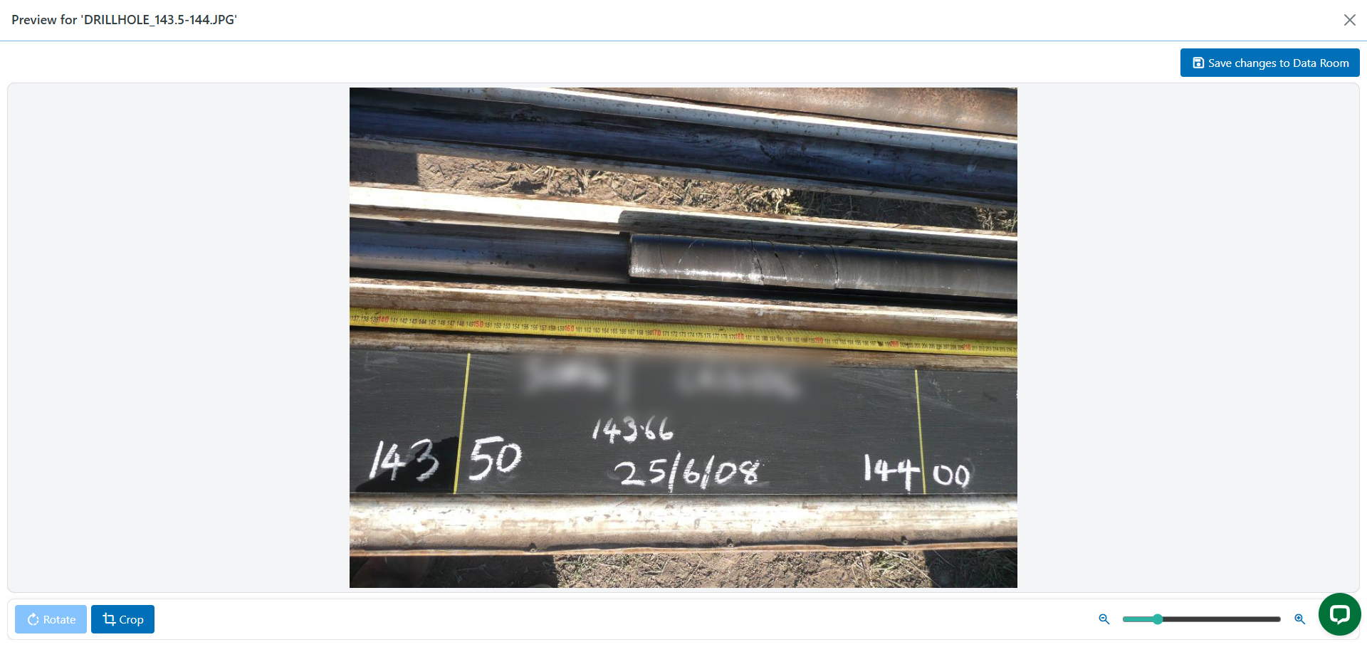
The data room now brings powerful editing capabilities directly into your workflow, removing the need to download files for simple updates. Preview, edit, and save XLSX and CSV files directly within the data room, with familiar spreadsheet functionality including cell formatting and styling. Core photos can also be adjusted on the fly with built-in crop and rotate tools, while text and LAS files can be edited directly without leaving the platform. These enhancements make it faster and easier to review, update, and manage project data in one central location.
Additional platform improvements
Improved calculated columns
Calculated columns now support simplified expressions like “is null” and “is not null”, replacing complex “if null” formulas and making logic easier to build and read. These updates also fix table duplication issues, ensuring calculated columns are preserved correctly and fully supported across exports and imports.
Expanded full screen data entry
Full screen mode in data entry now provides a true edge-to-edge experience, hiding the top and left navigation panels to maximise screen space when logging in the field.
Improved photo panel navigation
The data entry photo panel now supports zooming in and out, with navigation controls remaining visible at all times for easier image review.
Platform upgrade to .NET 10
1point has been upgraded to .NET 10, delivering the latest framework improvements and supporting continued platform performance, stability, and future development.