Image

1slate

Tenement management software, but better

LogCheck

A comprehensive, affordable software and database system for simplifying management of your exploration/coal data.


Check out our pricing calculator
Find out more about LogCheck
TRY LOGCHECK FOR FREE FOR 60 DAYS!
Image

1slate

Tenement management software, but better

LogCheck

A comprehensive, affordable software and database system for simplifying management of your exploration/coal data.

LogCheck

A comprehensive, affordable software and database system for simplifying management of your exploration/coal data.

Check out our pricing calculator
Find out more about LogCheck
TRY LOGCHECK FOR FREE FOR 60 DAYS!
Image

LogCheck

LogCheck


Image


LOGCHECK OVERVIEW
LogCheck enables users to enter their log data, correct errors, validate the data and visualise it in cross sections.

LogCheck has four modules:

  • Basic module
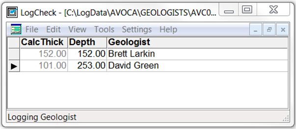
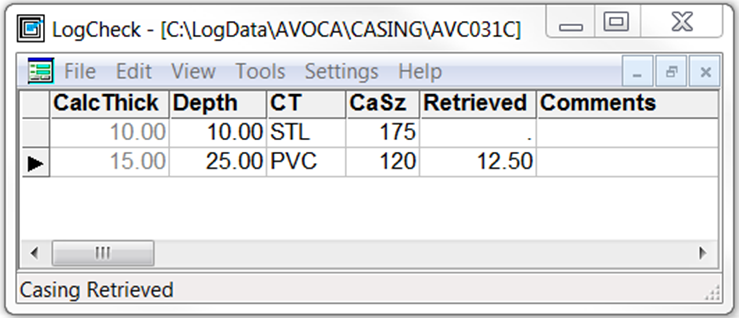
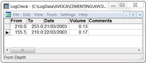
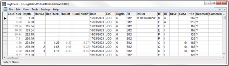
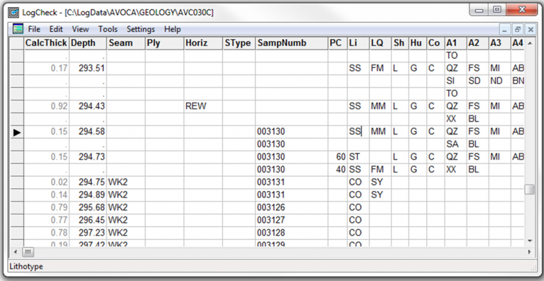
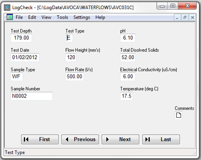
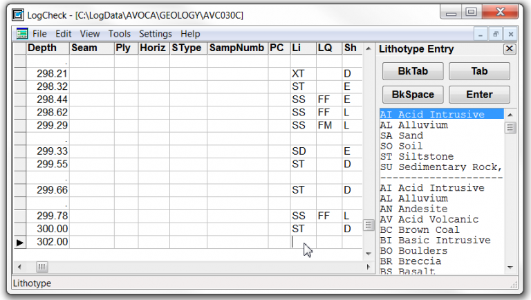
    Headers, Geology, LAS, Cementing, Drilling, Geologists, PointLoads, WaterFlows, Basic Coal Quality ONLY
  • Geotechnical module
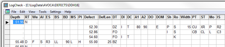
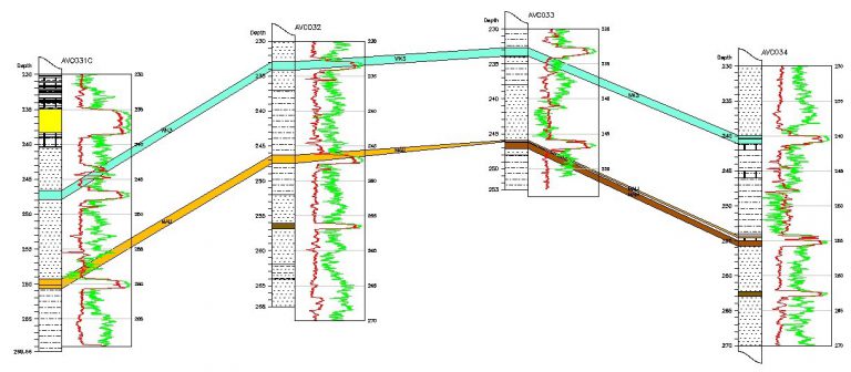
    Uses the Defects data to plot the geotechnical detail as recorded from the drill hole for the design of both opencut and underground operations
  • Graphical Editor module
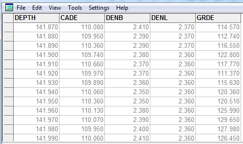
    Works with LAS data to graphically enable the user to “adjust” Geology depths to align with LAS depths
  • Coal Quality module
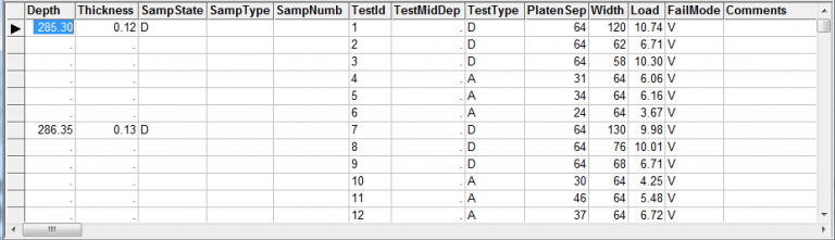
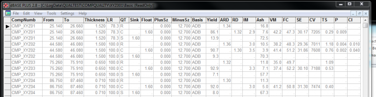
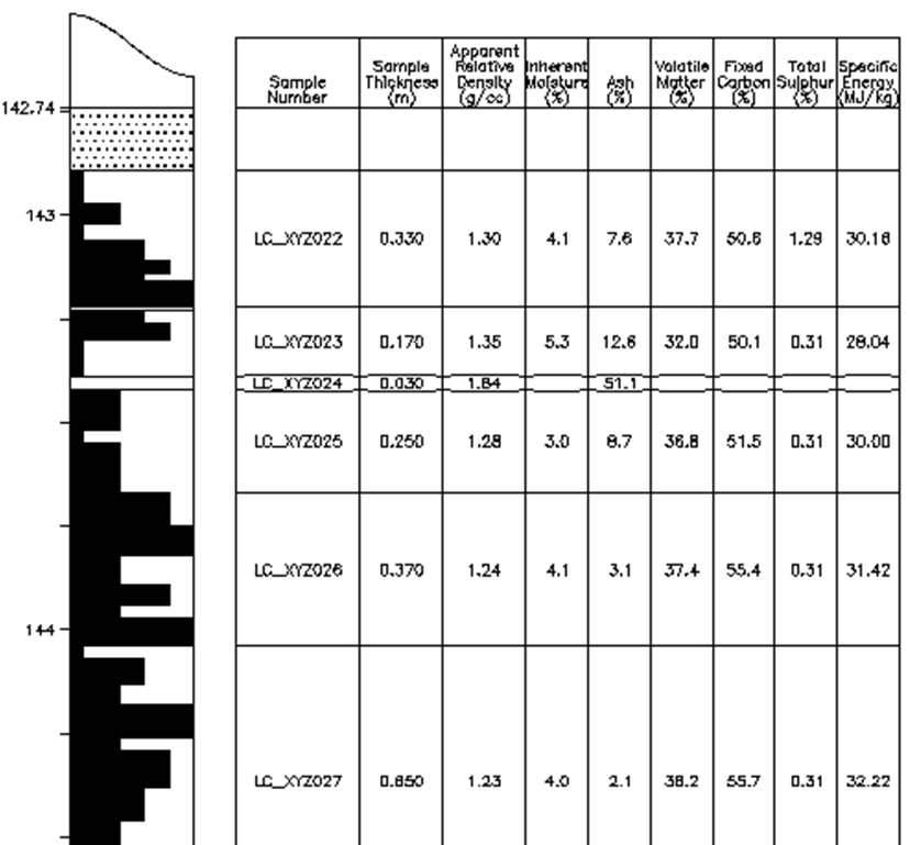
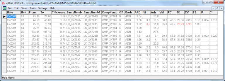
    All forms of Coal Quality data; for example – proximates, ultimates, composites, AFT, Ash analysis, maceral analysis, coking tests, sizing, float/sink analyses, stored and validated against “standard” CQ ranges of data, and then graphically plotted as required

LogCheck uses dBase as its relational database platform.

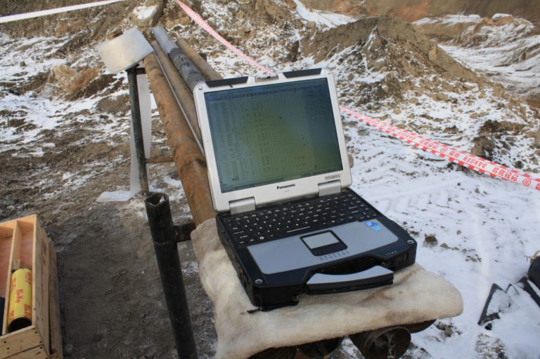
Logcheck software saves you time as the database functionality is already developed enabling you to get to work correcting, visualising and validating your data.

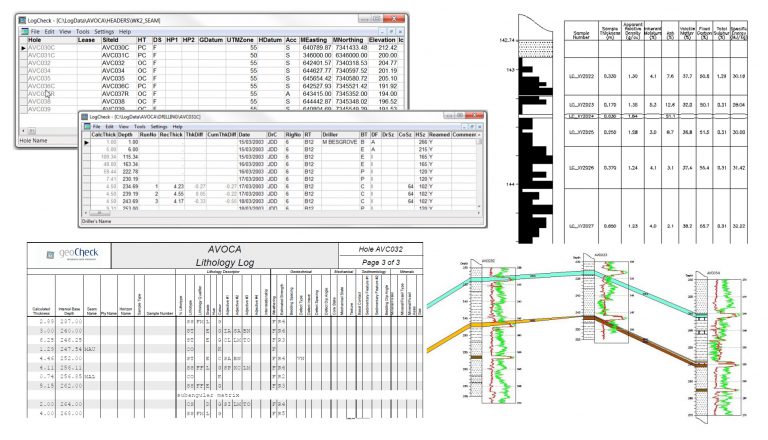
LogCheck is a Windows-based software system for the management of coal exploration data. It includes facilities for:

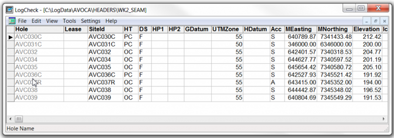
  • data entry, validation, plotting and production of English reports for hole header (location information), drilling, water flow, downhole geological and geotechnical (rock mass unit, defect and point load) data,
  • plotting and geological log depth adjustment using downhole geophysical data,
  • import and export of dictionaries and data to and from geological databases and modelling packages, such as Acquire, Geobank, MineScape (GDB), Vulcan, Minex and Englog,
  • production of various audits and summaries, including summaries of: data currently stored for each hole; dictionary code usage; drilling meterage; seams, horizons and samples in each hole; contents of downhole geophysical (LAS) files; rock mass unit characteristics and point load indices,
  • compilation of detailed CQ data from various analytical bases into a linked database system that verifies the data entry, allows some manipulation of the coal data into composites over seams and then the export of this data for further modelling.
Image

Freeware products to use with LogCheck:

  • Trueview – Autocad software
    This allows you to view the dxf outputs from the graphical output of LogCheck general  and Geotechnical Module
  • Primo PDF
    Primo is a freeware pdf writer.  This helps produce a pdf from the dxf graphical output.
  • LAS certify software
    Allows you to check las files and see if they are matching the LAS standards.

DOWNLOAD THE LOGCHECK MANUAL
DOWNLOAD COALLOG
DICTIONARIES & RESOURCES

LogCheck Data Types

HEADER DATA

Header data consists of data for which there is only a single value for the entire hole.  For example, the hole name, hole purpose, collar survey (easting, northing and elevation), total depth, geological logging organisation, etc.

Image

GEOLOGIST DATA

The Geologist data records the names of the geologist(s) who logged the hole, and what depth ranges they logged. The fields are Base Depth and Logging Geologist.

Image

CASING DATA

The Casing data records the depth to which casing was run in the hole and the type of casing used, eg PVC, steel, steel threaded.  Also the size of the casing used is recorded.

Image

CEMENTING DATA

Volume of cement can be recorded  for each hole.

Image

DRILLING DATA

For each hole, the drilling data can be recorded. The compulsory fields are Base Depth, Bit Type and for cored intervals, the Core Size.

Image

GEOLOGY DATA

Geology data stores calculated thickness,  Interval base depth, Sample Number, Seam/strat name, Lithotype, % lithotype, Comments, etc.

Image

LAS DATA

The LAS file records geophysical data obtained from logging a hole, such as gamma, density and caliper recordings.

Image

DEFECT DATA

Defect data in LogCheck, has two parts– on the left hand side, from the Depth column up to but not including the Defect column, are Rock Mass Unit (RMU) details. A single RMU has uniform geotechnical characteristics. It is a broader grouping than just a single lithology and will often consist of multiple lithology units. On the right hand side, from the Defect column on, is a description of each of the defects.

Image

POINT LOAD TEST DATA

In a point load test, a stick of core is subject to compressive forces in either an axial (along the axis of the core) or diametral (across the core) directions, until the core fails. The force measured is the force in kN at which the core fails.

Image

WATER FLOW DATA

Water flow is flow out of the hole from particular depths on a particular date.

Image

LogCheck Features

DATA ENTRY & EDITING

LogCheck supports a number of widely used data sheet formats or can be tailored to match the client’s specific needs. Data can be imported from Geobank, Acquire, MineScape (GDB), Vulcan, Minex, Excel .csv or Englog text files or entered directly.

Image

DATA LISTING

Data can be listed in its original format or as reports with codes converted to full English descriptions. In either case, the listings can be produced either as PDF’s or text files for importing to other software such as Excel or Word.

Image
Image

GRAPHICAL EDITING

The Graphical Editor (GeoEdit) is used for graphically displaying hole data, and aligning depths of lithologies with the downhole geophysics. GeoEdit reads data from a hole log generated from LogCheck, and displays the lithology, seam, ply, sample number, mechanical state and geophysics in a graphical format.


DATA PLOTTING

Plots are generated as industry standard .dxf files which can be displayed, edited and/or plotted from nearly any CAD package.

There are four type of plot that produced by LogCheck: Drillhole Location, down hole plots, histogram, and box and whisker plots.

Image
Image

COAL QUALITY

The coal quality features in LogCheck have been dramatically extended from earlier versions. It now has facilities for recording Coal Quality data not only for raw samples but also for various mesh sizes and float fractions. It also now includes facilities for recording results for both individual and combined ply composites.

The variables that can now be recorded include:

  • Basic Properties: Relative Density, Moisture, Ash, Volatile Matter, Fixed Carbon, Energy, Total Sulphur, Phosphorus, Chlorine, Crucible Swell No. (CSN) and Hardgrove Grindability (HGI).
  • Ultimates & Sulphurs
  • Major Trace Elements
  • Minor Trace Elements
  • Macerals & Reflectances
  • Thermal Coal Properties
  • Coking Coal Properties

LogCheck also determines composite values for each Seam, Ply or each Seam + Ply combination. The user can control whether this is done by calculating them from the individual ply data, using analysed composite values or for each of the variables within each composite use the analysed composite value.


Image
Image

LogCheck Features

DATA ENTRY & EDITING

LogCheck supports a number of widely used data sheet formats or can be tailored to match the client’s specific needs. Data can be imported from Geobank, Acquire, MineScape (GDB), Vulcan, Minex, Excel .csv or Englog text files or entered directly.

Image

DATA LISTING

Data can be listed in its original format or as reports with codes converted to full English descriptions. In either case, the listings can be produced either as PDF’s or text files for importing to other software such as Excel or Word.

Image
Image

GRAPHICAL EDITING

The Graphical Editor (GeoEdit) is used for graphically displaying hole data, and aligning depths of lithologies with the downhole geophysics. GeoEdit reads data from a hole log generated from LogCheck, and displays the lithology, seam, ply, sample number, mechanical state and geophysics in a graphical format.


DATA PLOTTING

Plots are generated as industry standard .dxf files which can be displayed, edited and/or plotted from nearly any CAD package.

There are four type of plot that produced by LogCheck: Drillhole Location, down hole plots, histogram, and box and whisker plots.

Image

COAL QUALITY

The coal quality features in LogCheck have been dramatically extended from earlier versions. It now has facilities for recording Coal Quality data not only for raw samples but also for various mesh sizes and float fractions. It also now includes facilities for recording results for both individual and combined ply composites. The variables that can now be recorded include:

  • Basic Properties: Relative Density, Moisture, Ash, Volatile Matter, Fixed Carbon, Energy, Total Sulphur, Phosphorus, Chlorine, Crucible Swell No. (CSN) and Hardgrove Grindability (HGI).
  • Ultimates & Sulphurs
  • Major Trace Elements
  • Minor Trace Elements
  • Macerals & Reflectances
  • Thermal Coal Properties
  • Coking Coal Properties

LogCheck also determines composite values for each Seam, Ply or each Seam + Ply combination. The user can control whether this is done by calculating them from the individual ply data, using analysed composite values or for each of the variables within each composite use the analysed composite value.

Image
Image
Image

Looking to get a new LogCheck licence, transfer or renew existing subscription?


Licence Request Form

pricing calculator

pricing calculator

What will LogCheck cost?

Type in your number of licences below to find out the annual cost to simplify your geological data management with LogCheck.


number of licenses


cost per year

=


plus gst

pricing charts

LogCheck: Geological data management software, but better

pricing charts

LogCheck: Geological data management software, but better

0 to 5
licenses

$2,500

Per License / Per Year
  • Technical support & helpdesk staffed by the people who designed the software
  • Free updates for the life of your license/s
GET LOGCHECK!

16 to 30
licences

$33,900 for first 15 licenses
PLUS

$1,785

Per License / Per Year over 15
  • Technical support & helpdesk staffed by the people who designed the software
  • Free updates for the life of your license/s
GET LOGCHECK!

pricing charts

LogCheck: Geological data management software, but better

0 to 5
licenses

$2,500

Per License / Per Year
  • Technical support & helpdesk staffed by the people who designed the software
  • Free updates for the life of your license/s
GET LOGCHECK!


16 to 30
licences

$33,900 for first 15 licenses
PLUS

$1,785

Per License / Per Year over 15
  • Technical support & helpdesk staffed by the people who designed the software
  • Free updates for the life of your license/s
GET LOGCHECK!


Image

Ready to simplify your coal/exploration data management?

Let's go!